In architectural design and urban development, visual communication is essential. One of the most impactful ways to communicate the scope, design intent, and potential of a large-scale development is through masterplanning visuals. These high-quality, often photorealistic visualisations play a vital role in urban planning, stakeholder engagement, public consultations, and marketing efforts. At North Made Studio, producing masterplanning visuals is a discipline rooted in experience, technical expertise, and an in-depth understanding of what decision-makers and the public need to see.
This article explores the importance of masterplanning visuals, how they are created, and why they are indispensable for large-scale property and infrastructure projects.
What Are Masterplanning Visuals?
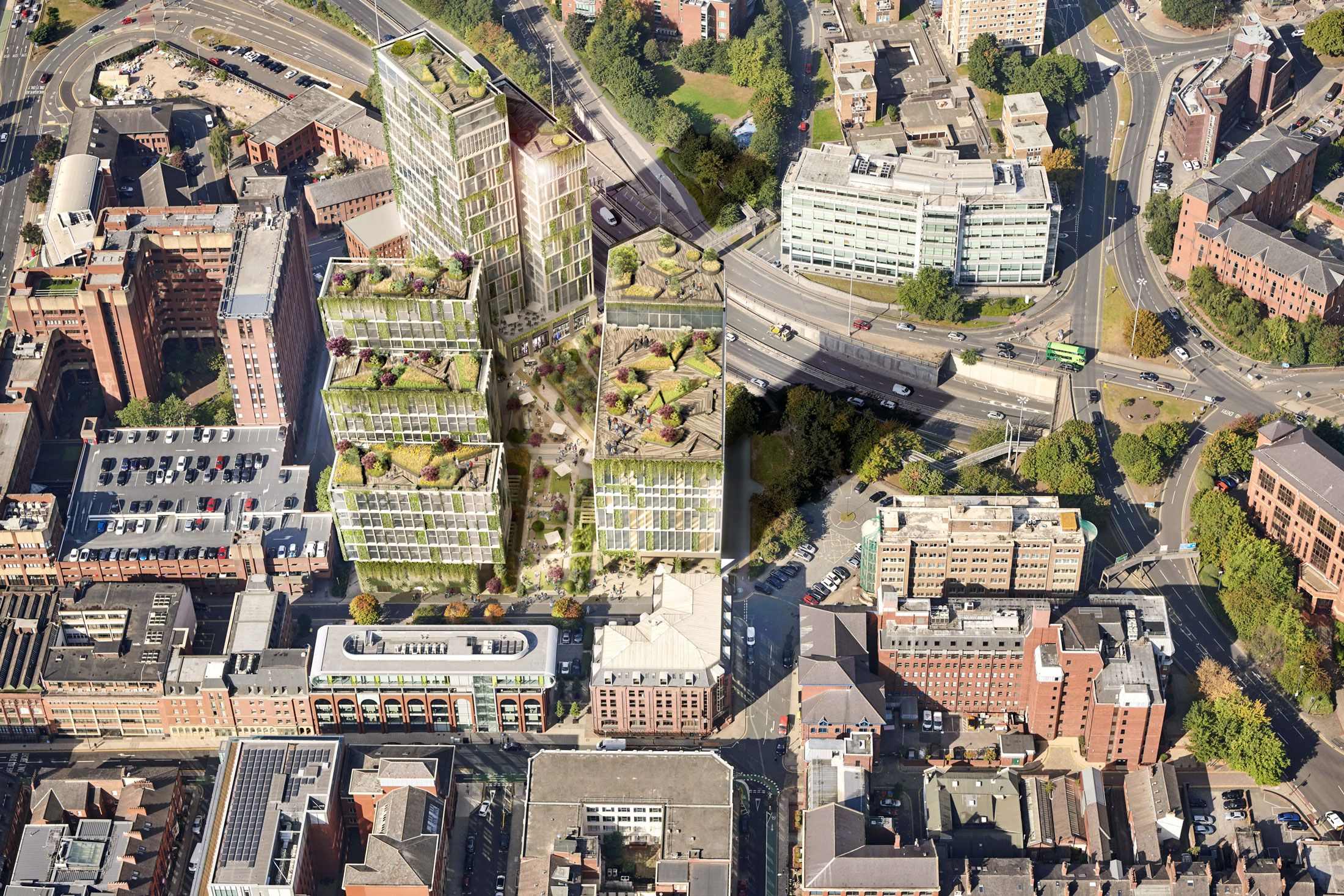
Masterplanning visuals are high-level digital representations of extensive development schemes. These include urban regeneration projects, residential and commercial districts, infrastructure hubs, and multi-phase mixed-use developments. Unlike a single-building CGI render, a masterplan visual must capture a broader context, spanning multiple buildings, streetscapes, landscaping elements, and even transportation networks.
These visuals serve to:
- Present an overall vision of the development
- Aid communication between planners, architects, developers, and local authorities
- Support planning applications and public engagement
- Provide marketing teams with compelling assets for investment and sales
Why Are They Essential in Urban Development?
1. Clarifying Scale and Scope
Large projects involve multiple moving parts, and written descriptions or 2D plans rarely convey the true nature of such developments. Masterplanning visuals offer a clear, digestible overview. Stakeholders can see how components like residential blocks, retail areas, green spaces, and roads interconnect. This clarity reduces misunderstandings and helps gain buy-in from planning officers and the public.
2. Supporting Planning Applications
Most UK planning authorities require some form of visual material with large applications. Planning officers need to understand massing, height relationships, density, and impact on the local environment. A well-constructed masterplan visual shows the development in its urban context, demonstrating compliance with planning policy and addressing concerns like overshadowing or visual impact.
3. Engaging Communities and Local Councils
When developers hold public consultations, especially for contentious or transformative urban projects, clear and attractive visuals are vital. They help residents, councillors, and stakeholders understand what is being proposed. People engage far more easily with visual content than with architectural jargon or technical drawings.
Effective visuals can build support, dispel myths, and show how a development can add value to a community through public spaces, better infrastructure, and access to amenities.
4. Attracting Investors and Buyers
Before ground is broken, developers often need to secure funding or begin marketing off-plan units. Masterplanning visuals become a cornerstone of investor presentations and marketing campaigns. These visual assets can be used across brochures, websites, and exhibitions, allowing potential investors and buyers to understand the quality, ambition, and location of the development.
The Process of Creating Masterplanning Visuals
At North Made Studio, the creation of a masterplan visual is a collaborative and technically precise process. It typically involves the following steps:
1. Briefing and Contextual Understanding
The first step involves obtaining detailed architectural plans, 3D models (if available), planning documentation, and any contextual data such as OS mapping, drone imagery, or site photography. North Made works closely with architects, planners, and developers to fully understand the development’s intent, phasing, and design objectives.
2. 3D Modelling and Spatial Planning
In many cases, North Made will develop the masterplan from scratch, constructing a 3D model based on architectural drawings. This includes not just buildings, but landscaping, roads, footpaths, site boundaries, and any key landmarks or neighbouring structures.
Spatial relationships, access points, and key vistas are carefully considered. The goal is to provide a coherent and realistic overview that accurately reflects what will be built.
3. Rendering and Composition
Once the model is complete, the visual team determines the most effective angles and lighting conditions for showcasing the development. The rendering process is carried out using industry-leading software to produce high-resolution, photorealistic visuals. These might include wide-angle views from an aerial perspective or street-level visuals showing key public spaces.
Textures, shadows, environmental lighting, and landscaping elements are added to increase realism and relatability.
4. Post-Production and Revisions
The rendered visuals are then processed in post-production, where detail is refined, colour balance is adjusted, and additional elements such as people, vehicles, or greenery are integrated. Feedback loops with the client ensure that the final image meets all expectations and accurately reflects the design.
Formats and Uses of Masterplan Visuals
The visuals produced may take a variety of forms depending on the project phase and intended audience:
- Static Renders: High-quality images for brochures, planning packs, or website use.
- Animated Flythroughs: Useful for exhibitions and investor presentations, showing progression through different parts of the development.
- Interactive Models: Web-based or app-integrated 3D models that users can explore at their own pace.
- Verified Views: When planning requirements are stringent, verified views can be integrated with the masterplan to demonstrate sightlines and visual impact.
Challenges and Considerations
Creating impactful and accurate masterplanning visuals is not without challenges. These can include:
- Changing Design Requirements: As designs evolve, visuals may need to be updated quickly to remain aligned with architectural intent.
- Data Accuracy: For visuals that are used in planning, accuracy is critical. Survey data, building heights, and photogrammetry must all be correct.
- Public Perception: Visuals must be both aspirational and realistic. Overly idealised renders can damage credibility if the final result does not match expectations.
A skilled visualisation studio understands how to balance these demands, producing content that is technically sound, artistically appealing, and aligned with client goals.
Why Choose North Made Studio?
North Made Studio combines architectural experience with creative flair. Based in Manchester and serving developers and architects across the UK, our team is trusted by major players in the property sector to deliver visual assets that support planning, marketing, and investment.
What sets North Made apart is our attention to detail, commitment to client collaboration, and ability to convey complex developments with clarity and style. Our team understands that large-scale developments shape communities and cities. Our visuals help shape the story behind those transformations.
Conclusion
In large-scale property and urban development, clear communication is key. Masterplanning visuals serve as a bridge between technical plans and public understanding, between architectural vision and financial backing. Whether it’s for planning consent, public consultation, or investor engagement, these visuals are a vital asset for any development team.
North Made Studio brings a high level of professionalism, creativity, and precision to every masterplan project, helping clients bring their visions to life, one image at a time.
If you are planning a major development and need impactful visuals that communicate your ambition, get in touch with North Made Studio today.